


05 Rogers Creek School Voting District, McMinn County, Tennessee
About
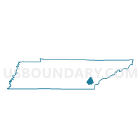
Outline

Summary
| Unique Area Identifier | 669125 |
| Name | 05 Rogers Creek School Voting District |
| County | McMinn County |
| State | Tennessee |
| Area (square miles) | 60.53 |
| Land Area (square miles) | 59.39 |
| Water Area (square miles) | 1.13 |
| % of Land Area | 98.13 |
| % of Water Area | 1.87 |
| Latitude of the Internal Point | 35.41936510 |
| Longtitude of the Internal Point | -84.77723050 |
Maps


Graphs
Select a template below for downloading or customizing gragh for 05 Rogers Creek School Voting District, McMinn County, Tennessee


Neighbors
Neighoring Voting District (by Name) Neighboring Voting District on the Map
- 06 Riceville School Voting District, McMinn County, TN
- 07 Calhoun School Voting District, McMinn County, TN
- 1 Eastview Voting District, Meigs County, TN
- 10 Tennessee Tech. Centerool Voting District, McMinn County, TN
- 103-1 Hopewell Voting District, Bradley County, TN
- 14 EK Baker School Voting District, McMinn County, TN
- 2 Meigs South Voting District, Meigs County, TN
- 202-1 Charleston Voting District, Bradley County, TN
- 3 Courthouse Voting District, Meigs County, TN
- 4 Meigs North Voting District, Meigs County, TN
Top 10 Neighboring County Subdivision (by Population) Neighboring County Subdivision on the Map
- District 1, Bradley County, TN (14,598)
- District 2, Bradley County, TN (14,554)
- District 2, McMinn County, TN (11,398)
- District 1, McMinn County, TN (10,457)
- District 5, McMinn County, TN (10,248)
- District 3, Meigs County, TN (3,321)
- District 2, Meigs County, TN (2,319)
- District 4, Meigs County, TN (2,074)
- District 1, Meigs County, TN (2,070)
Top 10 Neighboring Unified School District (by Population) Neighboring Unified School District on the Map
- Bradley County School District, TN (57,678)
- McMinn County School District, TN (35,318)
- Meigs County School District, TN (11,753)
Top 10 Neighboring State Legislative District Lower Chamber (by Population) Neighboring State Legislative District Lower Chamber on the Map
Top 10 Neighboring State Legislative District Upper Chamber (by Population) Neighboring State Legislative District Upper Chamber on the Map
Top 10 Neighboring 111th Congressional District (by Population) Neighboring 111th Congressional District on the Map
Top 10 Neighboring Census Tract (by Population) Neighboring Census Tract on the Map
- Census Tract 112.02, Bradley County, TN (8,917)
- Census Tract 9708, McMinn County, TN (7,272)
- Census Tract 113, Bradley County, TN (7,259)
- Census Tract 9701.01, McMinn County, TN (6,976)
- Census Tract 9602, Meigs County, TN (4,631)
- Census Tract 9603, Meigs County, TN (3,967)
Top 10 Neighboring 5-Digit ZIP Code Tabulation Area (by Population) Neighboring 5-Digit ZIP Code Tabulation Area on the Map
- 37303, TN (25,461)
- 37322, TN (8,239)
- 37370, TN (4,652)
- 37336, TN (4,202)
- 37310, TN (4,135)
- 37309, TN (2,138)